Division of Gorton
| Gorton Australian House of Representatives Division | |
|---|---|
 Division of Gorton in Victoria, as of the 2022 federal election | |
| Created | 2004 |
| MP | Brendan O'Connor |
| Party | Labor |
| Namesake | Sir John Gorton |
| Electors | 110,928 (2022) |
| Area | 217 km2 (83.8 sq mi) |
| Demographic | Outer metropolitan |
The Division of Gorton is an Australian Electoral Division in the state of Victoria.
History
[edit]
The division was created in 2004 to replace the abolished Division of Burke, and is named in honour Sir John Gorton, who served as the 19th prime Minister of Australia from 1968 to 1971. Gorton had served in the Senate from 1949 to 1968, before switching houses to represent the Victorian federal seat of Higgins until 1975.
The constituency of Gorton features a high proportion of young families and new suburban developments in the working-class outer western suburbs of the Melbourne metropolitan area.
Burke had been held by the Australian Labor Party for its entire existence, though it had become increasingly marginal since the 1980s. On its creation, it was a comfortably safe Labor seat with a majority of almost 20 percent. The last member for Burke, Brendan O'Connor, successfully transferred to Gorton in the 2004 federal election with only a small swing against him. He has held it ever since on fairly safe to safe margins.
Boundaries
[edit]Federal electoral division boundaries in Australia are determined at redistributions by a redistribution committee appointed by the Australian Electoral Commission. Redistributions occur for the boundaries of divisions in a particular state, and they occur every seven years, or sooner if a state's representation entitlement changes or when divisions of a state are malapportioned.[1]
Gorton is located in the outer western suburbs of Melbourne. As of 2021, it includes the suburbs of Aintree, Bonnie Brook, Burnside, Burnside Heights, Caroline Springs, Deanside, Deer Park, Delahey, Grangefields, Fieldstone, Fraser Rise, Keilor, Keilor Downs, Kings Park, Ravenhall, Rockbank, Sydenham, Taylors Hill, Taylors Lakes, Thornhill Park, Truganina and parts of Deer Park, Derrimut, Hillside and Mount Cottrell.[2][3]
It previously included the suburbs of Albanvale, Brookfield, Cairnlea, Cobblebank, Harkness, Kurunjang, Melton, Melton South, Plumpton and Strathtulloh; parts of Diggers Rest, Parwan, and Toolern Vale; as well as the townships of Exford and Eynesbury prior to past redistributions.
Members
[edit]| Image | Member | Party | Term | Notes | |
|---|---|---|---|---|---|

|
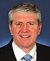
Brendan O'Connor (1962–) |
Labor | 9 October 2004 – present |
Previously held the Division of Burke. Served as minister under Rudd and Gillard. Incumbent. Currently a minister under Albanese | |
Election results
[edit]| Party | Candidate | Votes | % | ±% | |
|---|---|---|---|---|---|
| Labor | Brendan O'Connor | 38,178 | 41.30 | −10.13 | |
| Liberal | John Fletcher | 25,350 | 27.42 | −0.56 | |
| Greens | Praise Morris | 8,325 | 9.01 | +1.58 | |
| United Australia | Michael Virag | 7,082 | 7.66 | +0.36 | |
| One Nation | Daniel Connor | 6,719 | 7.27 | +7.27 | |
| Independent | Steven Loncar | 2,341 | 2.53 | +2.53 | |
| Victorian Socialists | Belle Gibson | 2,064 | 2.23 | +2.23 | |
| Great Australian | Tony Dobran | 1,312 | 1.42 | +0.64 | |
| Federation | Paul Lassig | 1,063 | 1.15 | +1.15 | |
| Total formal votes | 92,434 | 92.88 | −1.04 | ||
| Informal votes | 7,089 | 7.12 | +1.04 | ||
| Turnout | 99,523 | 89.77 | −1.24 | ||
| Two-party-preferred result | |||||
| Labor | Brendan O'Connor | 55,434 | 59.97 | −4.27 | |
| Liberal | John Fletcher | 37,000 | 40.03 | +4.27 | |
| Labor hold | Swing | −4.27 | |||

 indicates at what stage the winning candidate had over 50% of the votes and was declared the winner.
Graphs are unavailable due to technical issues. Updates on reimplementing the Graph extension, which will be known as the Chart extension, can be found on Phabricator and on MediaWiki.org. |
Graphs are unavailable due to technical issues. Updates on reimplementing the Graph extension, which will be known as the Chart extension, can be found on Phabricator and on MediaWiki.org. |
References
[edit]- ^ Muller, Damon (14 November 2017). "The process of federal redistributions: a quick guide". Parliament of Australia. Retrieved 19 April 2022.
- ^ "July 2021 MAP OF COMMONWEALTH ELECTORAL DIVISION OF GORTON" (PDF). Australian Electoral Commission. Retrieved 31 May 2022.
- ^ "augmented Electoral Commission for Victoria, Redistribution of Victoria into electoral divisions" (PDF). Australian Electoral Commission. augmented Electoral Commission for Victoria. p. 101. Retrieved 31 May 2022.
- ^ Gorton, VIC, 2022 Tally Room, Australian Electoral Commission.
